![]()
|
LE PORT LAVIGNE
| Back to the arial vue
|
|
|
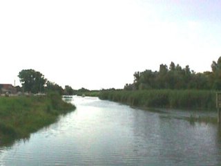
Located on a once
important branch of the Loire, le Port Lavigne used to
be a rocky islet that clearly emerged from the
alluvial plain. There, ships from America would unload their goods : the
quay and the remains of the warehouses are the last evidence
of that activity . Indeed, the silting of the river
has made it impossible for ships with great draught to navigate. Only the
shallow boats of amateur or occupational fishermen
are allowed today.
| The Port Lavigne branch hardly lives on nowadays. Major harbour development policies have been carried out so as to cut off all the secondary branches by dyking them up or filling them in. The mud clog then moved landward and caused a considerable silting up of the river. A sluice has recently been built upstream so as to keep what remains of the channel from the salty and muddy streams of flowing tide. | 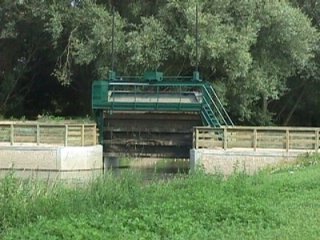 |
|
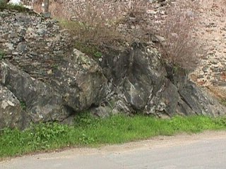
Right in the middle of the main branch of the Loire, the massive amphibolite platform of Port Lavigne provides a solid foundation for the houses and the ancient warehouses and protects them from great floods. |
| Since the achievement of considerable improvement works in the harbour, the water level in Nantes has gone by several metres down to sea level. Back in the nineteenth century, the islets and the sands banks scattered along the middle estuary impeded the flow to the ocean and so allowed greater floods to reach the bases of the houses in Port Lavigne. | 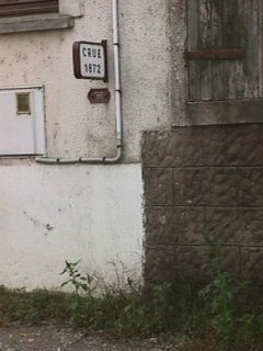 |
|
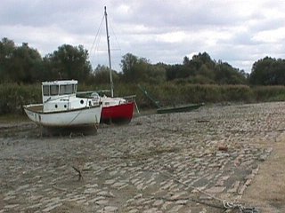
Evidence of the past harbour activity, this stone-paved quay or slipway allowed small boats to run aground and open sea ships to unload thanks to long foot-bridges or lighters. |
| Nowadays, the harbour activity has come down to smaller fishing carried out by amateur fishermen, retired or unemployed people. These small traditional boats are equipped with square fishing nets to catch flatfish and white-fleshed fish that live on the muddy bottom of the cutoff branches. Back | 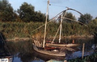 |
|